Where are there more cases of African swine fever? How many cases of ASF have been detected in pigs in a given area? What is the status of an outbreak? At Pig333 we have improved our map of ASF outbreaks, turning it into an interactive map, with the data updated weekly using data from the World Organization for Animal Health (WOAH).
From the map legend, you can choose to display or hide outbreaks in wild boar and pigs, choose between isolated cases or clusters, and between active or resolved outbreaks. This will help you to find outbreaks on the map, as you can hide the outbreaks you are not looking for.
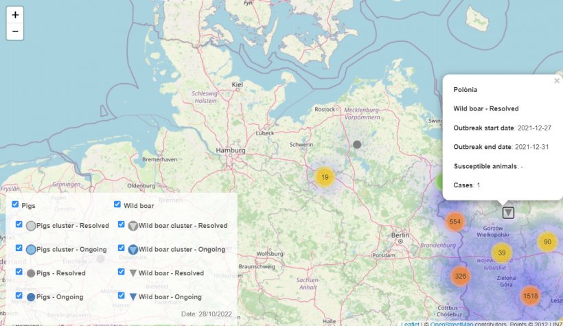

When you click on an outbreak a window appears with more information:
- Location, province, and country.
- Species (pigs or wild boar) and status (active or resolved).
- Start date of the outbreak.
- End date of the outbreak (if already resolved).
- Susceptible animals (on a farm).
- Cases (number of positive animals).


Visit our section on African swine fever to explore the map and view a compilation of information related to the disease: articles, the latest news, description of the disease, photos of lesions, and other informative resources.


